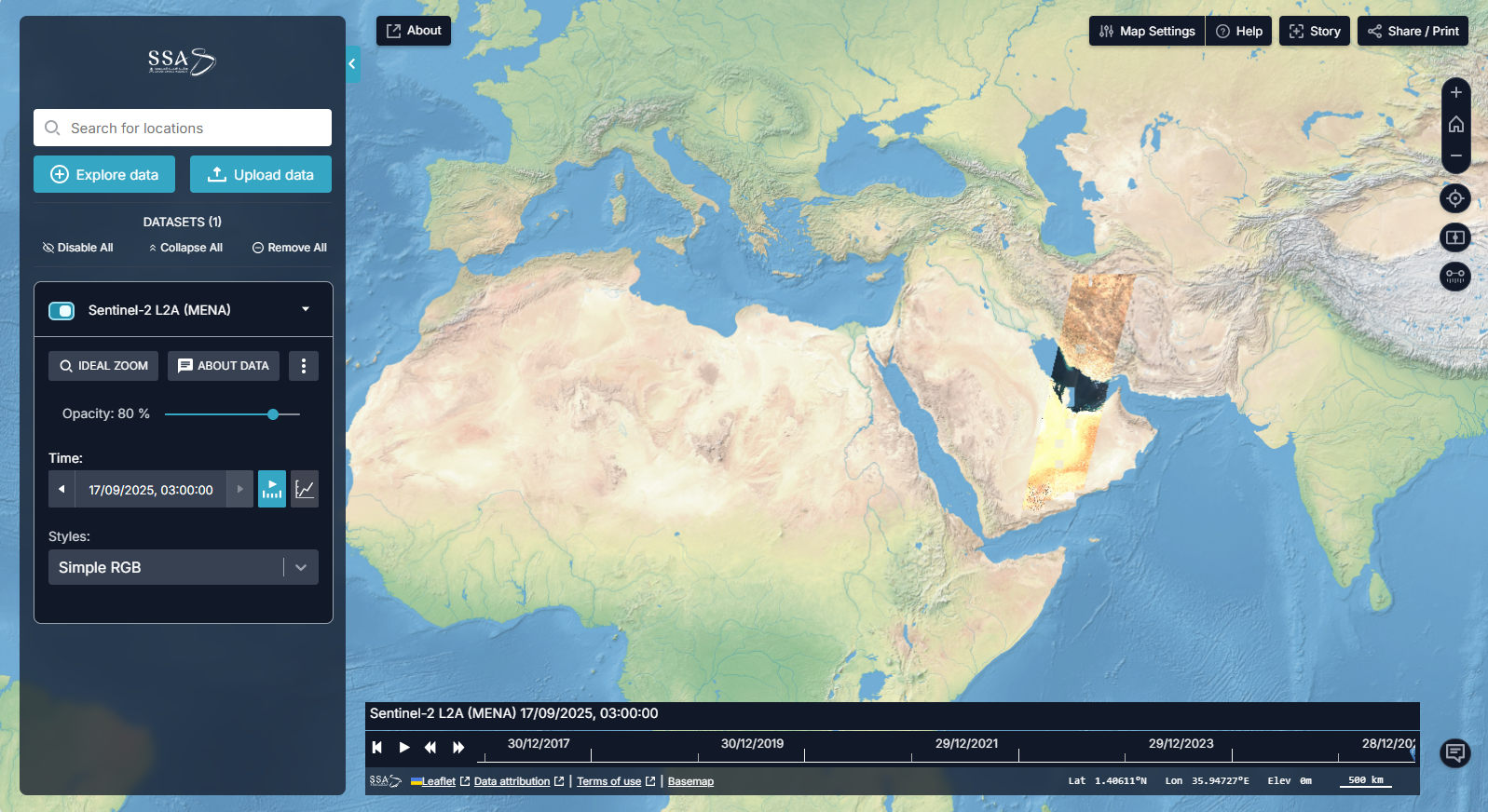

you are a student, analyst, or planner who needs to see pre-made data products and understand changes over time without code
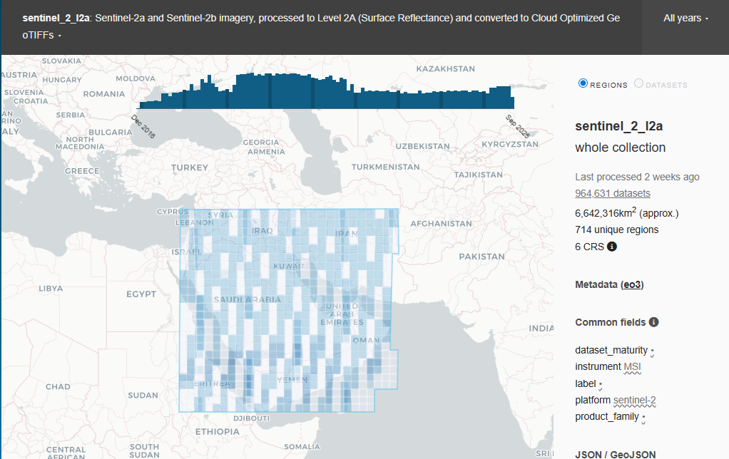
you are a researcher or professional who needs to find and filter specific satellite data for a project
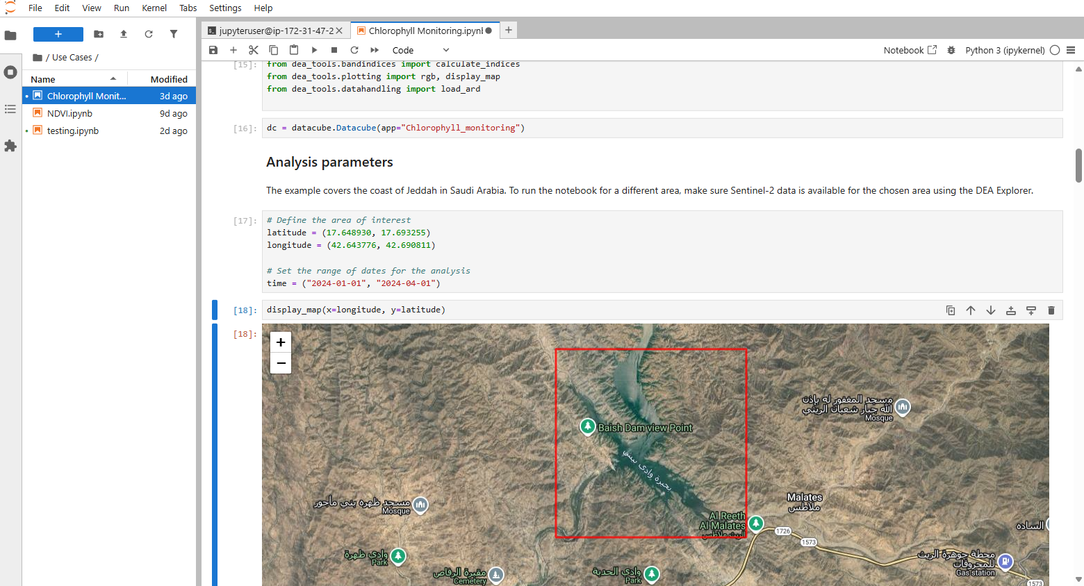
you are a data scientist, developer, or advanced researcher who needs to write code, run complex models, and build new applications